

Both maps
Where the map you drew appears
A floor can keep Map 2.0 and Classic drawings. App, signage, visitor and admin surfaces select a supported family; guest-booking floor-plan selection currently uses Classic.
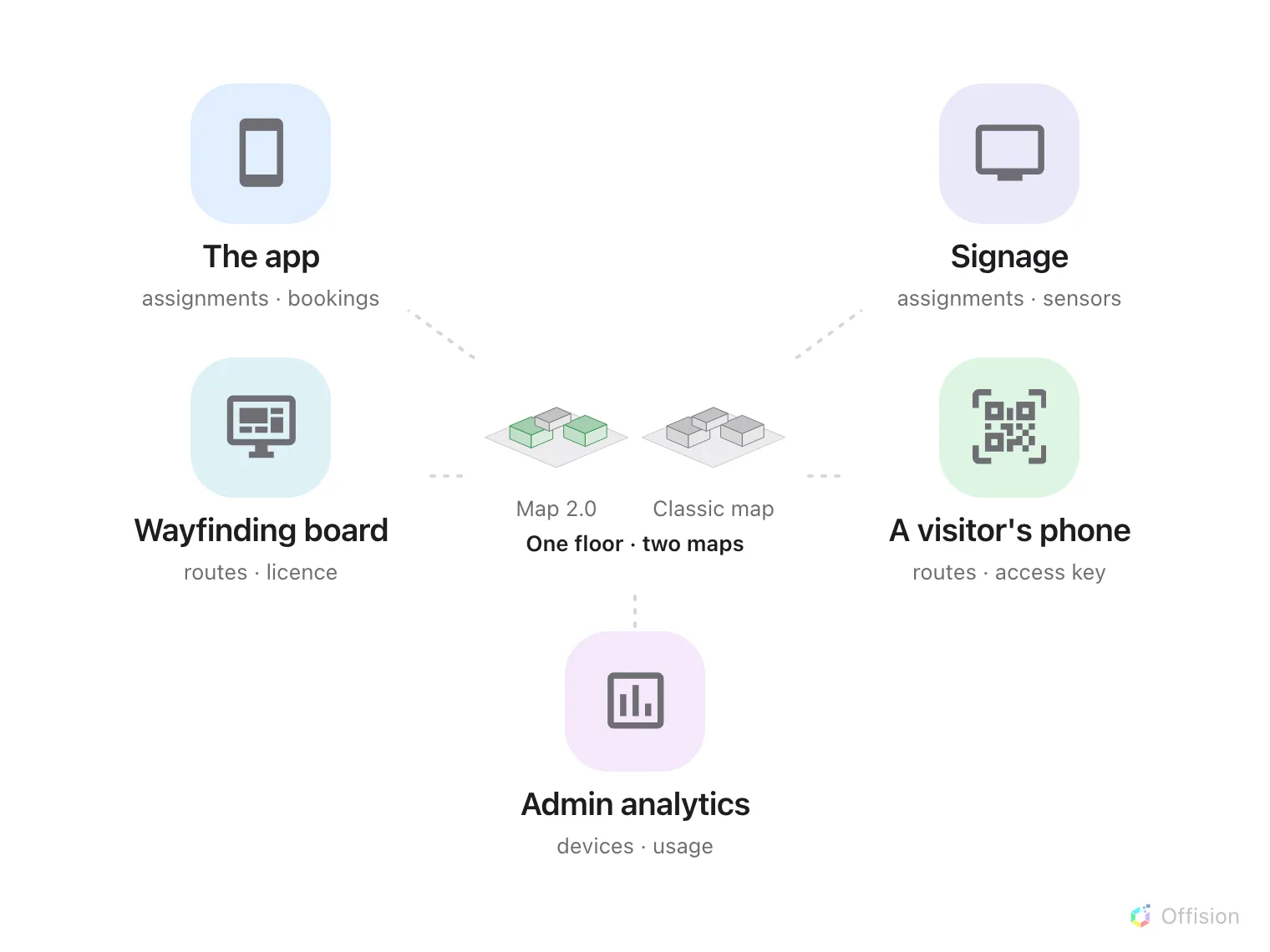
One floor can keep both map families. The selected family and the surface determine which drawing people see.
A floor can store both a Map 2.0 scene and a Classic drawing. Each surface reads the map family selected for that floor and account; they are not two views of one drawing. Editing one family does not automatically redraw the other.
The app, signage and wayfinding can display Map 2.0 where enabled. Guest-booking floor-plan selection currently uses Classic; check the surface you are preparing instead of assuming every map appears everywhere. Use Identify your map before following authoring instructions. Each surface is configured in its own module.
In the app, in somebody’s pocket
The map is how an employee finds a room they have never been to and a desk near somebody they want to sit with. They can filter it by what they are looking for, move a time slider so “free” means free when they need it, and book from the map without leaving it.
This is the surface that punishes an unassigned resource most visibly: a desk nobody linked is a desk nobody can pick. See Find a desk on the floor plan.
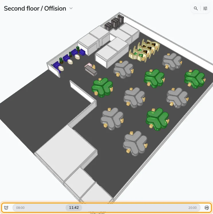
The floor in the app: filter, slide the time, book from the map.
On the screens people walk past
Signage draws the same floor for a room full of people rather than one person:
- Booking status - Map colours every room and desk by whether it is free.
- Occupancy sensor data - Map colours by what the sensors actually see, which is a different question and often a different answer.
The following camera controls and screenshots describe Classic widgets. They are widgets placed on signage content, and each can be given its own view angle — so a wall-mounted screen can look at the floor differently from the way the app does. Booking status - Map goes further and can drop the perspective altogether, drawing the floor flat from above and turned to match how the panel is mounted: Show the floor plan flat, in 2D. See Signage content.
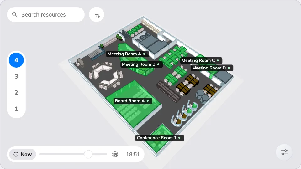
Booking status - Map, on a signage screen.
As a wayfinding board
A large touchscreen in a lobby is the map’s most demanding audience: strangers, in a hurry, who will not scroll. It shows the floor, takes a destination, and hands the route to a phone by QR so the person can walk away with it.
That is the surface that depends on everything in this module at once — the drawing, the assignments, the route network and the per-floor licence. See Set up a Neat Board as wayfinding signage.
To a visitor checking in
A guest who checks themselves in at a lobby screen is handed their destination on the spot: the room’s name, its floor and building, and that floor drawn with the room lit up. Where the screen has its own place on a plan, an inset map pins where the guest is standing.
It is the one map surface nobody navigates to — it arrives, unasked, because somebody arrived. See Show a visitor the way to the room they are visiting.
To a visitor’s phone
Scanning a wayfinding QR — from a board, or from a printed location access key — opens the floor on the visitor’s own phone. They search for the room, see it framed on the map, then walk it one step at a time, with the floor changing itself at the lift. No account, no app. See What a visitor sees after they scan.
In the admin console, quietly
Three read-only surfaces show floors using the map support available in that view, and they are the reason facilities teams end up caring about a map that employees rarely open:
- Device monitoring puts your panels and sensors on the floor, so an offline device is somewhere rather than a row in a list.
- Resource usage analytics colours the floor by how much each room is actually used — the view that ends arguments about which rooms to convert.
- IAQ and cost views do the same for air quality and for spend.
What decides who sees what
Nothing here, and that is worth saying plainly. A map never widens what somebody may see: people are shown the resources they already had access to, on whichever floors they already had access to. A map makes things findable, not permitted.