

Classic map
What an Offision map is made of
The one thing that confuses everybody about the 3D map: you never draw in 3D. A floor sized once, shapes drawn flat, a height on each of them, and the rooms and desks linked to those shapes.
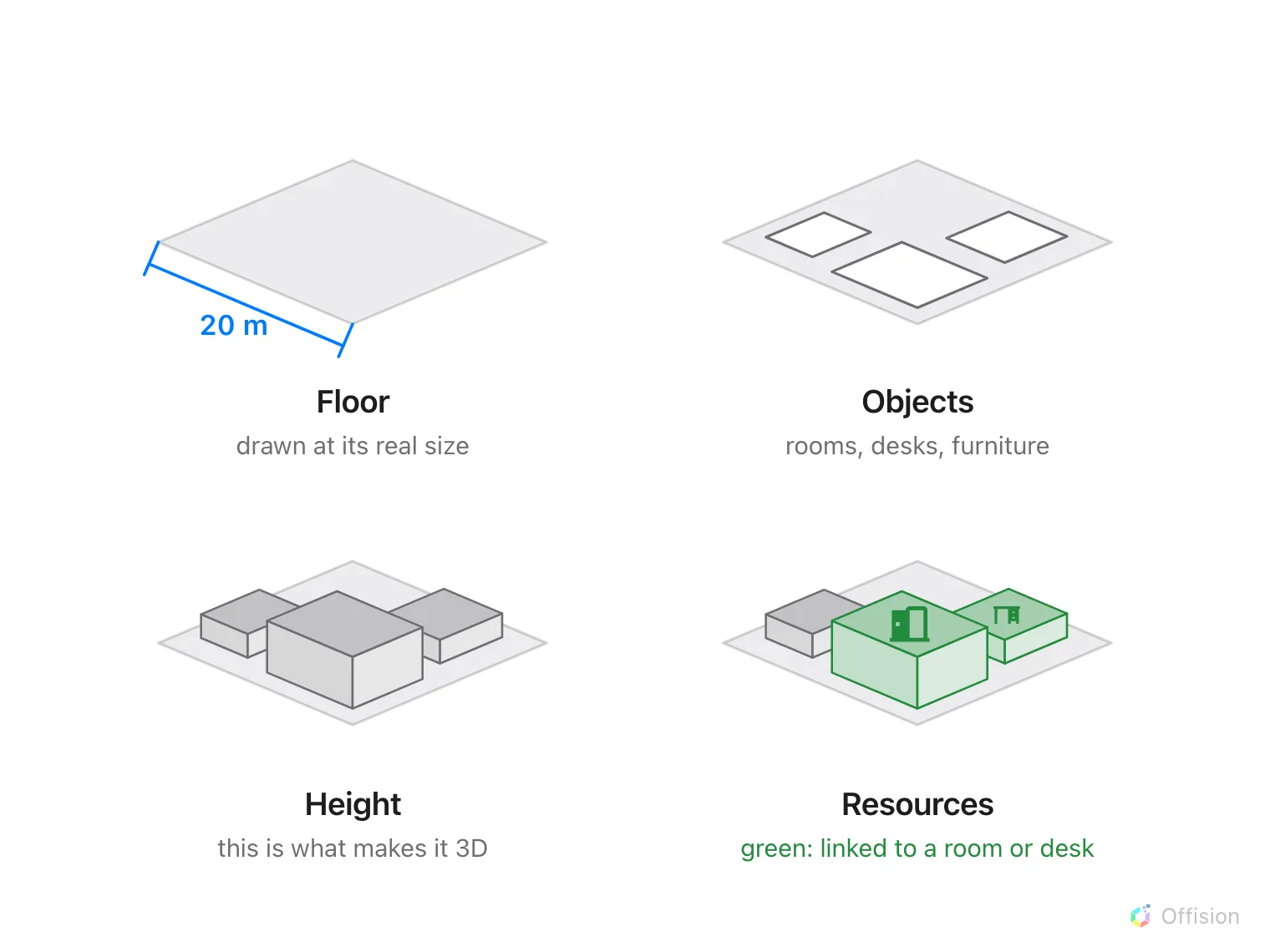
A floor sized once, shapes drawn flat, a height on each, and the rooms and desks linked to them.
You never draw in 3D
This is the thing worth knowing before anything else, because it is what sends people hunting through the console for a mode that does not exist.
You draw a flat plan, seen from above — rectangles, ellipses and furniture shapes. Then you give each shape a height. The 3D map is what comes out of that; it is not something you build in. 3D preview is a tab for looking at the result and saving the angle it opens at.
So the whole job is three moves: draw flat, set heights, preview in 3D.
One map per floor
A map belongs to a floor, and a floor has one. That is why the map lives under a building and its floors rather than under your rooms: the floor is the thing being drawn, and the rooms are placed onto it afterwards.
Open MapIt is measured in real metres
The editor is not a drawing canvas with arbitrary units. When you import a plan it asks for the actual floor dimensions, and every number after that — an object’s width, its depth, its height, the clearance a walking route keeps from a wall — is in metres or feet.
Get that first number wrong and nothing else is wrong in an obvious way: the map looks right, and only the routes and the sense of scale in 3D are off. It is the one value worth checking twice.
The four modes are four different jobs
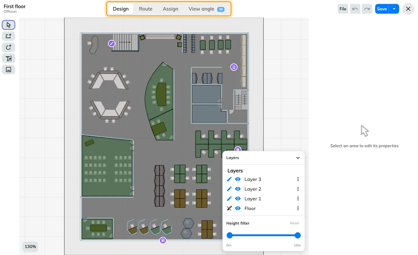
The same floor, four ways of working on it.
- Design draws the floor: the shapes, their colours, their heights.
- Route draws the paths people walk, so the map can give directions.
- Assign links a shape on the map to a room or desk in your estate.
- 3D preview shows the result and saves the angle every other screen opens the floor at.
Design, Route and Assign all work on the same flat plan. Switching between them changes the tools down the left and the panel on the right, never the drawing.
A shape and a room are two different things
The most useful distinction in the whole module. A rectangle you draw is an area — it has a size, a colour and a height, and that is all. A room is a thing in your estate that people book.
Assign is what joins them. Until a shape is assigned it is decoration: the app will draw it, and nobody can book anything from it. And because they are separate, redrawing a floor does not touch a single booking.
What it does not cover
- Buildings and floors are created in Locations, not here. The map draws the inside of a floor that already exists.
- Rooms and desks are created in Booking. The editor can add a missing one without leaving the screen, but it is still the Booking form doing it.
- What the labels look like on a finished map — which names show, and when — is a display setting under UI customization.
- Lockers, sensors and panels are placed on a floor from their own forms, each with its own “pick a spot on the map” dialog. Assign covers rooms, desks, equipment, parking spaces and facilities only.